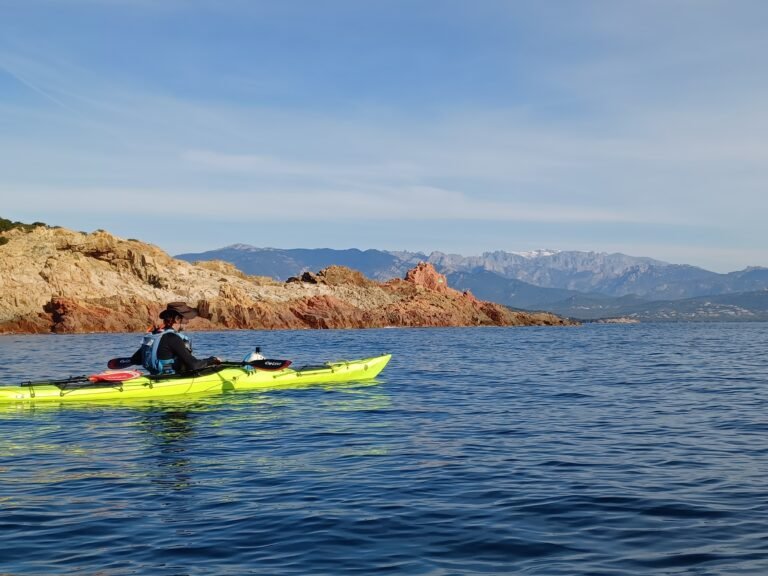

You must certainly have heard of the Calanques de Piana, a well know area that is listed as a UNESCO World Heritage site. The Calanques stand between Ajaccio and Calvi, on the West Coast of Corsica. The incredible contrast off its blazing red and the turquoise water of the sea have made this area very famous. Hiking in the Calanques de Piana is now an major activity here in Corsica.
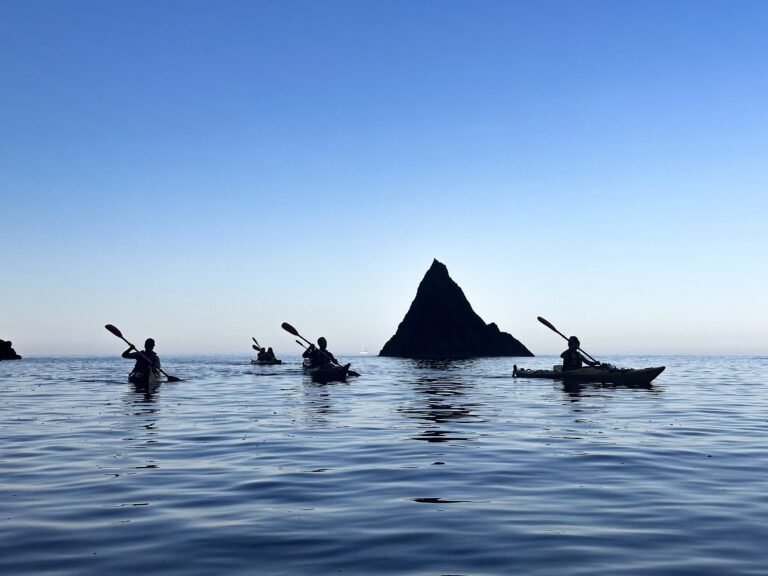
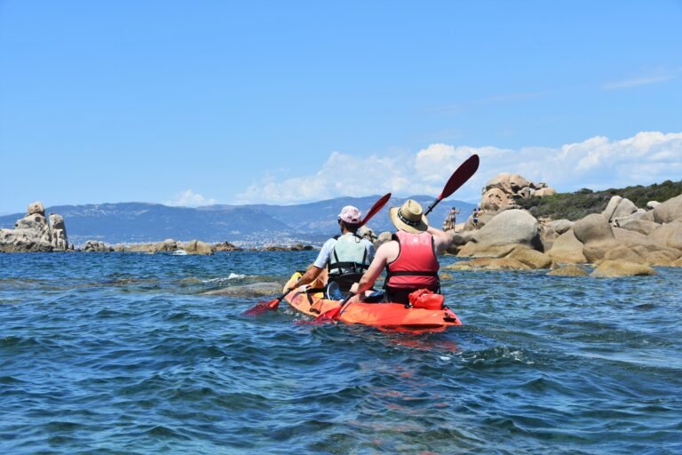
There are many ways to discover the Calanques de Piana. For example you can cross them by car with the one and only road that linksPiana to Porto, by the sea thank to our guided stay Les Calanques de l’île de Beauté, or by boat with one of the many compagnies based in Porto.
In this article, we give you up the 3 best place to go hiking in the Calanques de Piana.
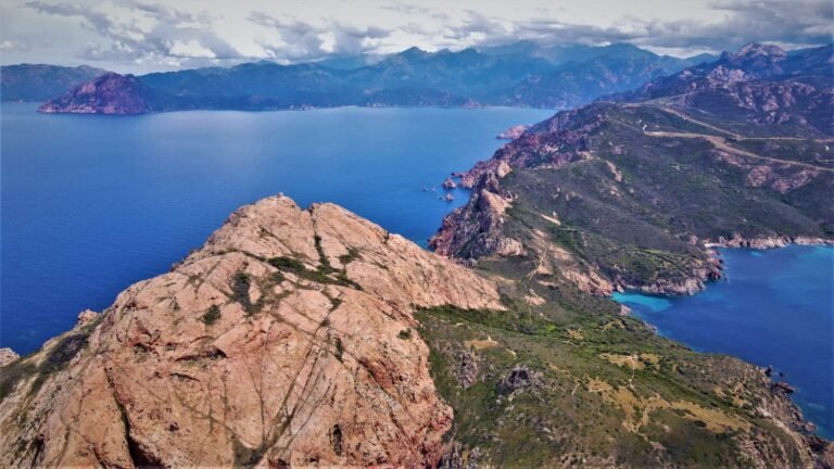
Capu Rossu and the Tower of Turghiu, an amazing overview on the Calanques de Piana


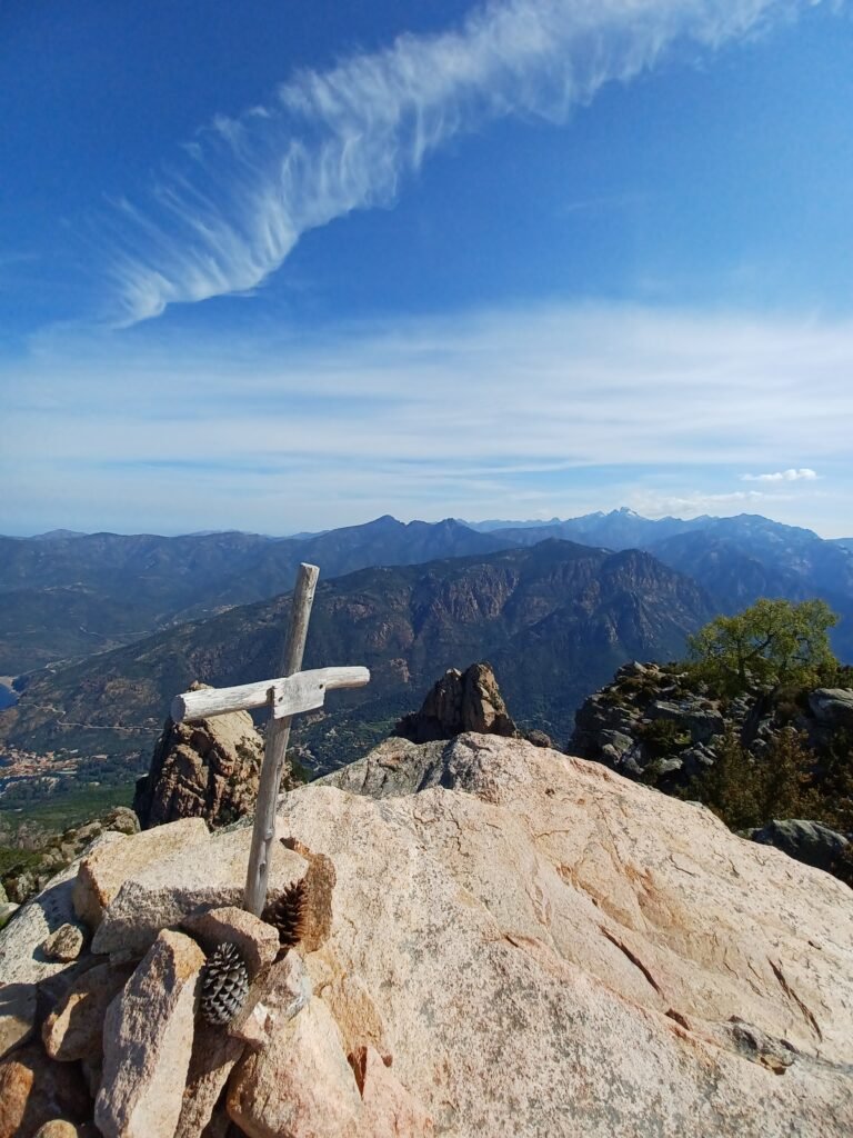
Above all the most famous hike around the Calanques de Piana is Capu Rossu. In the heart of the Calanques de Piana, you will walk along the coastline in order to reach the well-known Tower of Turghiu that overlooks the Calanques.
Summit : Tower of Turghiu – 330m
IGNMap : Ref. 4150OT
Starting point : 42.235398698061616, 8.583264900027201.
Round trip
Distance : 7,8km
4h of walking
Elevation gain : +454 – 456
Itinerary
In order to reach the starting point of this hike, you will have to ride on the winding routes that links Piana to Arone. After 15 minutes driving, you will catch sight a car park on your right. The breathtaking landscapes you can admire on the road gives you a taster of the panorama you will enjoy during the hike.
First, you have to follow the path that goes West to enter the nature reserve of the Parc Naturel Régional de Corse. During the entire hike, you can catch sight of the Genoese tower of Turghiu. You can enjoy an amazing view on both gulfs that surround the hike. The second option is to follow the coastal path. Therefore this hike is 30 minutes longer than the first one.
After a walk of an hour and a half, you finally reach former sheepfolds. There start the ascent to the summit to reach the Genoese tower. The path is even more technical as a part of is climb is made of scree. The more you climb, the harder it is to find the path. You have to scrupulously follow the cairns to reach your goal. Once you arrive at the tower, you can admire an overview on the Calanques de Piana and the Monte Senino, on the Gulf of Porto and the Gulfe of Arone.
To go back to the start, you have to follow the same path you just did. Once you reach the parking, it is time to enjoy a well-deserved refreshment on the restaurant while admiring the tower you reached before.
Please note that this hike is very exposed. In short, we do advise you to hike early in the morning, or in the late evening to enjoy the sunset. Make sure you have enough water.
Capu d’Orto : an overview on the Gulf of Porto and the Calanques
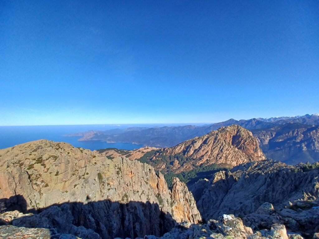
The hike of Capu d’Ortu offers as many various and spectacular landscapes as you can imagine. This summit overviews the sea on one side and the mountains on the other side. In this way, it allows you to admire the manys factes of Corsica, meaning an is a mountainous island surrounded by the sea. As a reward of your efforts, you can admire a breathtaking view on the Gulf of Porto, the tower or Capo Rosso and all the massifs of Corsica. Instead of hiking in the Calanques de Piana, this hike allows you to overlook this amazing place !
Summit : Capu d’Ortu – 1253m
IGNMap : Ref. 4150OT
Starting point : N 42.2397° / E 8.654744°
Round trip
Distance : 12km
6h of walking
Elevation gain : +848 – 847

Itinerary
The hike starts at the football stadium of Piana. From there you alternate between walking at the heart of the maquis and in a pine forest. Then you enter a path made of red scree, the Calanques de Piana’s main characteristic. As you follow this stony path, you can already admire an amazing panorama on the mountains. The crossing of two cliffs allows you to reach another forest. The Gulf of Porto finally starts to appear.
Now starts the climbing part of this hike. Please don’t be affraid ! There are cairns to follow in order to not get lost. Even if you will need your hands to reach the summit, this part remains easy. Once you reach the summit, you can enjoy an overview on the Gulf of Porto, the tower of Capo Rosso and the Calanques de Piana, and on the other side the entire mountain ranges of Corsica.
To go back to the start, you have to follow the same path than the one you followed the entire outward journey. Please follow carefully the cairns in order to not get lost in the stony part to reach the path in the pine forest.
Capu di U Vitullu, to overlook the Calanques de Piana

The summit accross from Capu d’Ortu is named Capu di U Vitullu. This is the place we are heading forth now.
Summit : Capu di U Vitullu – 1298m
IGNMap : Ref. 4150OT
Starting point : 42.236685116774765, 8.639537863408233. Start at the healthcare pathway above the city hall of Piana
Round trip
Distance : 14.58km
7h of walking
Elevation gain : +944 – 943
Itinerary
This hike starts in Piana. You have to follow the healthcare pathway which is above the city hall of Piana. It allows you to reach the official start. You can either start from the football stadium of Piana, such as Capu d’Ortu. The path weaves into the maquis and leads to a pine forest. Then you reach a red rocky path that refers to the Calanques de Piana.
Once you reach the crossing you have to follow Vitullu on your right. The other way will bring you to Capu d’Orto. You start you first ascent to reach the first col. From this place you can see the Gulf of Porto and the village of Piana, as well as the valley on the other side. Then you follow a sloping legde that overhangs the valley. Once you are in front of a rocky cliff, you must go around to the left. Then, you have to find a breach on the right to keep up walking. Then you need your hands to finally reach the summit. There you finally face a structure, this is an IGN sign. There, you can take the time to admire the Calanques de Piana and its Geneose tower, the Gulfs of Porto and of Arone. With a clear weater, you might be able to see the Paglia Orba and the Monte Cinto.
Bonus : La Tête de Chien, sunset above the Calanques de Piana
Summit : Capu di U Vitullu – 1298m
IGNMap : Ref. 4150OT
Starting point : 42.25289586280025, 8.657440014421619 Start at the parking at the corner next to La Tête de Chien
Round trip
Distance : 2.3km
1h15 of walking
Elevation gain : +65 – 54
Itinerary
We talked about emblematic hiking paths in the Calanques de Piana above in this article. Here is a little walk as a bonus ! The starting point is on the road between Porto and Piana, next to the famous rock known as “La Tête de Chien”. At first you have to walk on a stony path in the shade of a beautiful forest. As the elevation gain is insignificant and the walk quite short, this walk remains accessible. At the end, the path leads to cliffs. There you can admire a wonderful sunset above the Calanques de Piana and the Gulf of Porto. Please do not forget to bring headlamps to do the hike the other way and find back your car.